
(km 0 -50)
Like many other folks this year, I had been struggling with what to do with my vacation time. No where south of the border to go, no exotic places to get whisked off to. I had my eyes set on staying in BC. Specifically the Sunshine Coast Trail. This trail in its entirety spans 180km between Sarah Point and Saltery Bay. I was looking to tackle the northern section from Sarah point back to Powell River.
I secured a flight and transportation from the airport to the trailhead. Bag packed. Ready to go.
Monday morning finally rolled around, after a weekend of anticipating this trip, and all that I signed up for.
Day 1
The alarm went off and I was up. Quick coffee, quick toast. Call the cab. Say my goodbyes to the Misses and the youngster, and I’m out the door. A 5 minute cab ride (perks of living close to the airport), check in at the flight desk and before long the plane is taxiing to the tarmac. 30 minutes in the air is all it takes to get from Vancouver to Powell River, just long enough for you recognize how odd it feels to be on a plane full of people wearing facemasks.
I hop out of the plane and grab my pack. “You look like a Chris”. I hear being shouted from across the parking lot. It’s Jesse my ground transport waiting to pick me up. “Yup, that’s me” I reply as I load my bag into his SUV, and we leave the airport. “Is there somewhere I can fill my water before the trailhead?” I ask, “ya there’s a cafe around the corner. Might as well get that out of the way now”. I pop into Julie’s cafe and get my water bottle filled, I pick up a coffee and muffin for the drive. Poppy seed. Yum.
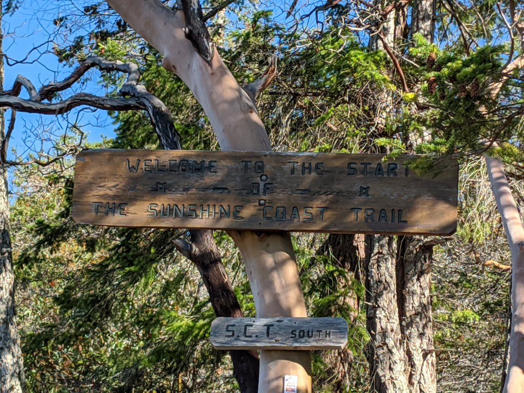
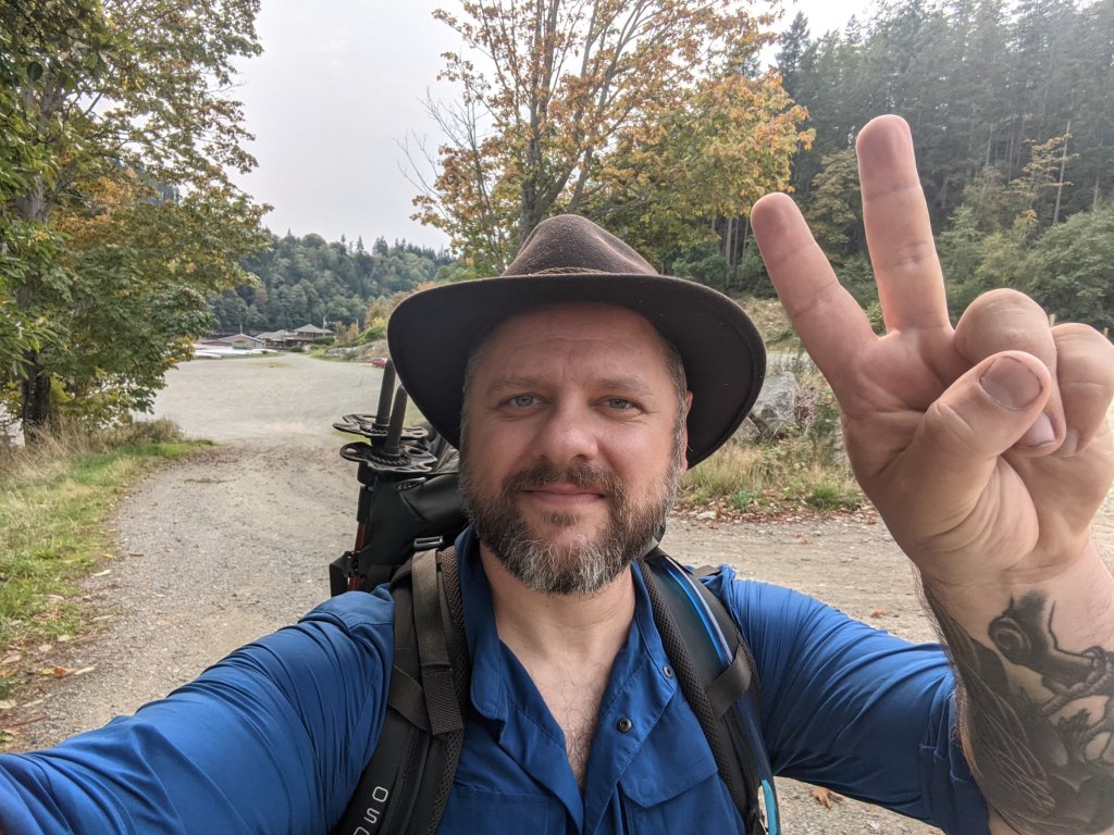
Jesse briefs me during the drive up on what I need to know, where do I plan on staying etc. He let me take a few photos of the water points along the way from his guide book. He also hands me an old map of the area. In Lund we switch vehicles and drivers. I say goodbye to Jesse and hello to Dennis, the other driver, and he takes me the remaining part of the way to the trailhead. Steep winding FSR’s get us to the drop off point. “Welcome to Sarah Point. This is where I leave you.” Says Dennis as I grab my stuff from the trunk. “Cheers” I replied and move my things off the roadway. The SUV drives off, and I am now alone on the northern tip of the Sunshine Coast.
I do a quick repack of my bag and get sorted. Grab my hiking poles and takes my first steps onto the SCT.
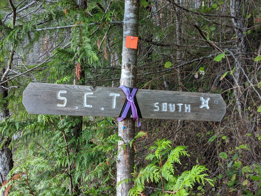
It’s about 1030am and already hotter than I expected. The trail actually heads north to wrap around the northern tip of the point before making a 180 degree turn and heading south for the remainder of the trail.
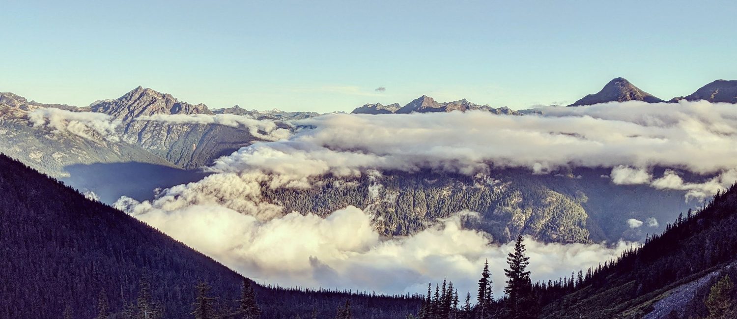
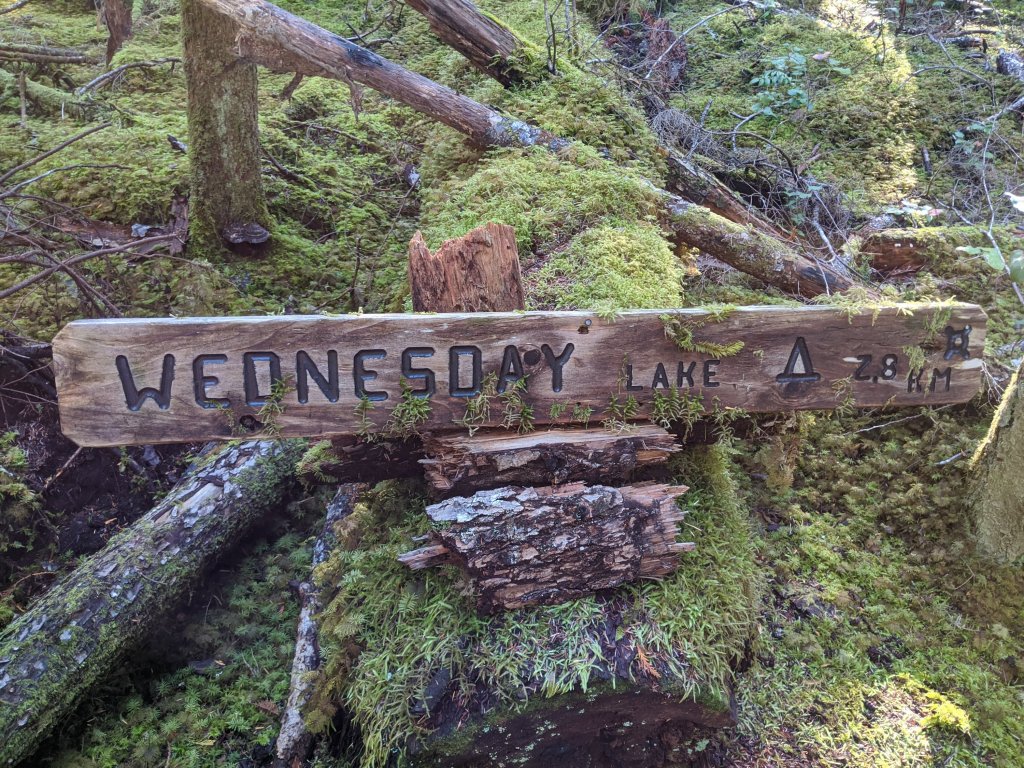
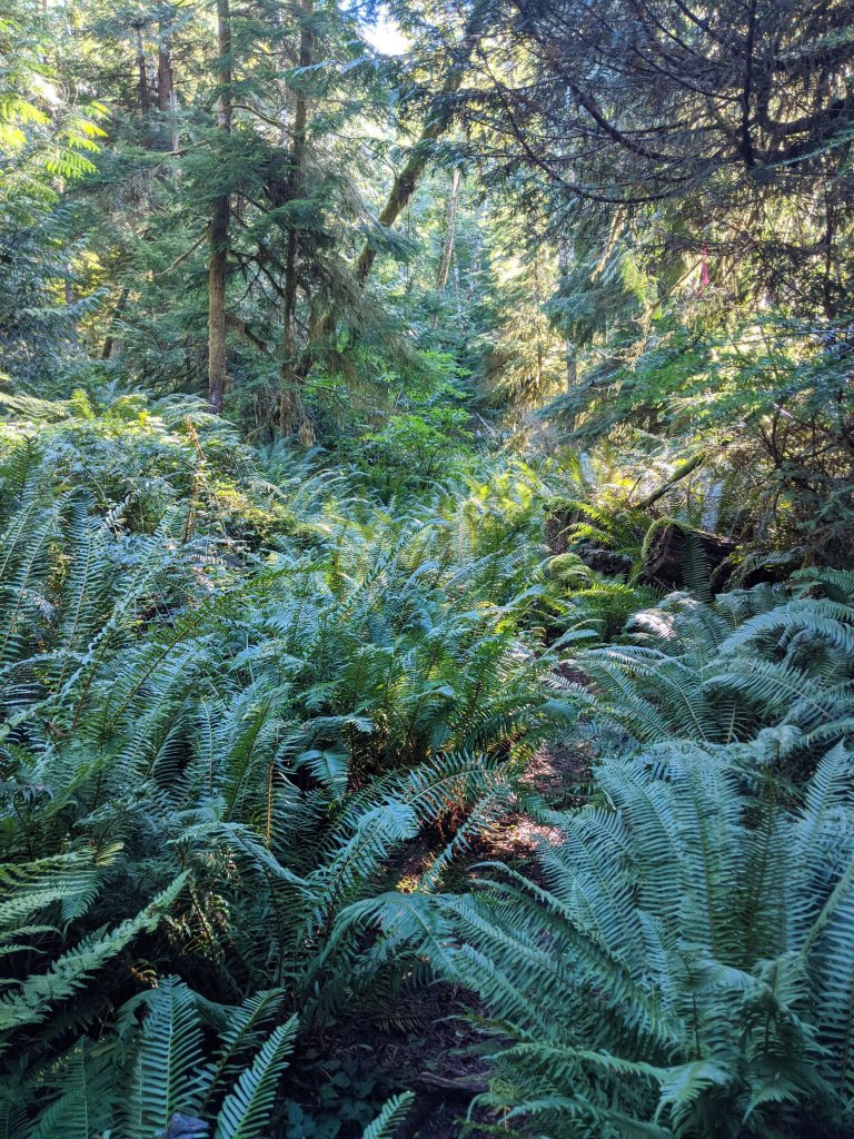
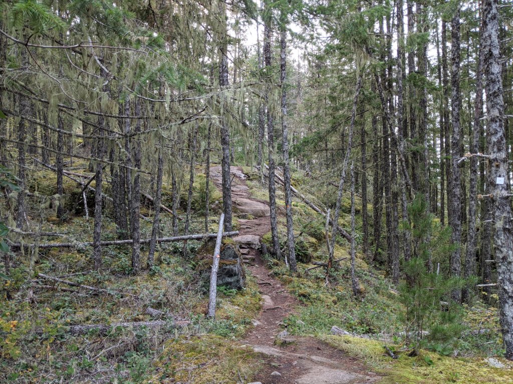
After the first few kms the forest gets a lot more dense, and ferns begin to take over the forest floor. There is also some sizeable giants for trees in here. Extremely impressive. Wandering past old stumps too, relics from the past. I made my way up to a big hill and took a break, I was hot, sun was beaming down on me. I dropped my pack and laid down for a while. Only a few more kms to go today. Thank goodness. I arrived at Wednesday Lake around 330pm and flat out called it quits for the day. I set up camp, ate dinner and made a few runs for water before it was lights out. 12km done.

Day 2
I was up by 7am. Such a quiet night on the lake. I ate some oatmeal and broke camp. The sun was just starting to crest the hill from the East. And I’m off. After yesterday’s heat I vowed to not fall victim of dehydration. I become systematic with my water. Every time I reached a km marker I drank. Every time I climbed a hill I drank. The morning went on. My system so far seemed to be working.
I approached butterfly bluff. There were some amazing natural rock gardens along the trail side. Before long I arrived at Manzanita Hut, which is set on a bluff overlooking the valley below. I chose to take a breather here before continuing on.

I believed I was making good time and started to descend down from the bluffs. The trail crossed an old logging road and then back up into the hills again. My plan was to make it to Plummer Creek, where it is listed as a camp and a place to refill water. Now if there is a camp there, I didn’t see it. I got chased by wasps for hanging around trying to find it. Bzzz.
The day was getting on, and I needed a back up plan. Homestead was another 3km away, which I wasn’t digging the idea of, but hey! At least it’s not like 10 more kms I told myself.
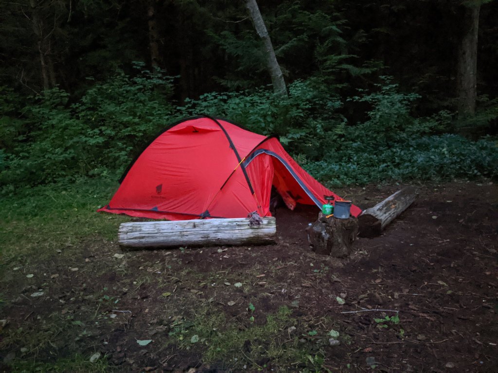
I arrived at Homestead with enough time to set camp and collect water for tomorrow before the sun set below the treeline. Tired, a longer day than expected. Caribbean curry with tuna for dinner. Yes please. I am now at km 29.
Day 3
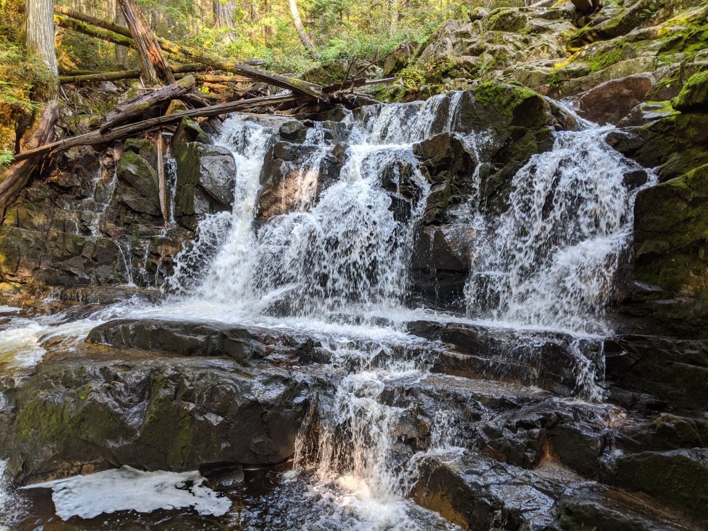
I awoke early to the sounds of empty logging trucks rumbling down the road. Homestead is situated on a spur road next to an active logging road. It was cooler than the previous 2 days had been, a promise that we are in fall. I opted for a breakfast of coffee and Mr Noodles. A little odd, but it worked. I set out and made my way up into the next section of trail, a zig zag of shared trail system until the SCT splits off and wanders around Rieveley Pond and the 3rd hut of the trail. A nice looking place to stay when the huts reopen again. Continuing on I pass Appleton Creek a few waterfalls, and Yeth Theth lake, then Sliammon Lake. I took a breather at Kokanee camp. Heals were starting to become problematic but I pushed on. The next camp was only a few more kms away and named Shangri-La. It had to be worth it,ya?
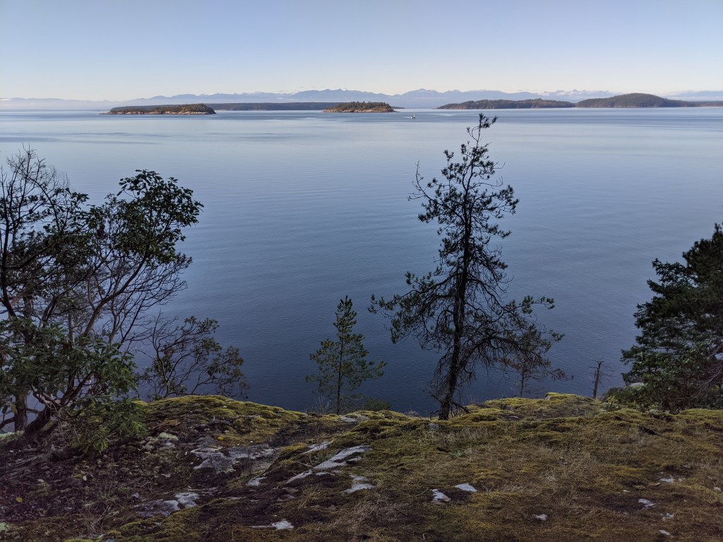
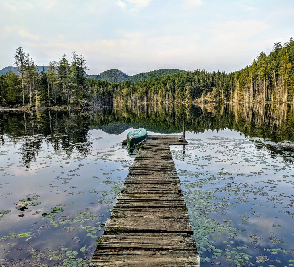
I finally reached camp and dropped my pack. Satisfied with my efforts up til now. I had tackled 43 kms of the trail, and a short day tomorrow would get me into Powell River. I ate, set up camp. Wrestled with snakes every 10 metres or so. I don’t have a problem with them so long as they just pass me by, but I swore if any of them turned towards me, it would have been world ender for them. There was a cool dock I checked out before calling it a night.
Day 4
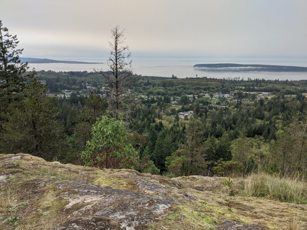
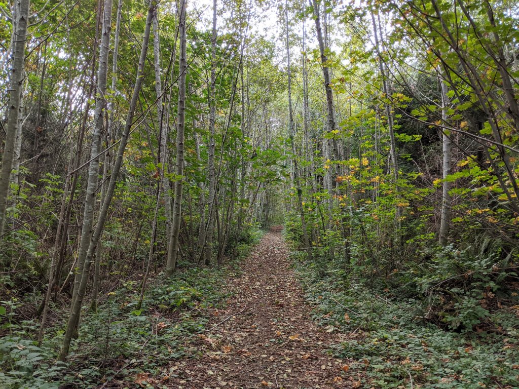
I woke slowly. No rush today. 7 more kms is all that lies in front of me until my destination. Enjoyed breakfast and coffee on the dock before heading out. I passed through some new growth, before making my way over the last hurdle of the trail. Scout mountain. Nice rolling hills up to the top and an opportunity to look down over the town. From there it was the home stretch.
I made my way down off of the mountain and down past a local rock climbing spot before getting to the edge of town. Lucky for me this particular edge of town happens to have a pub sitting on it. Shingle Mill pub, waiting to welcome hikers such as myself. I had to oblige. All good trails should end at a pub. That’s all I can say.
By the numbers
So here is the statistical break down for all of you:
Number of days hiking: 4
Total distance covered on map: 50.2 km
Total distance (including exploration,water runs, re routes, and the general understanding that we hike more than what it say on the map): 58 km
Number of wasp attacks: 1.
Number of times I was full on cursed out by chipmunks: 2.
Number of spiderwebs I walked through (specifically in my face): 10014. (Approx.)
A fantastic couple days on the trail. Well mapped out, well maintained. A gem of the Sunshine Coast. This trail is a must do. And with 180kms total, can easily be broken down into a number of smaller trips. I myself plan on heading back for another leg sometime soon.
Here’s a quick little video I put together of my trip.
Cheers

Looks awesome! Any other hikers or was it just you for 4 days? Either way looks like a great time 🙂
LikeLike
Just me. I ran into two couples on day hikes. That’s it.
LikeLike